Log in
All resources
Create a design
1,785 Free Artworks of Maps Of The World
world map
island of california on world maps
latin-language maps
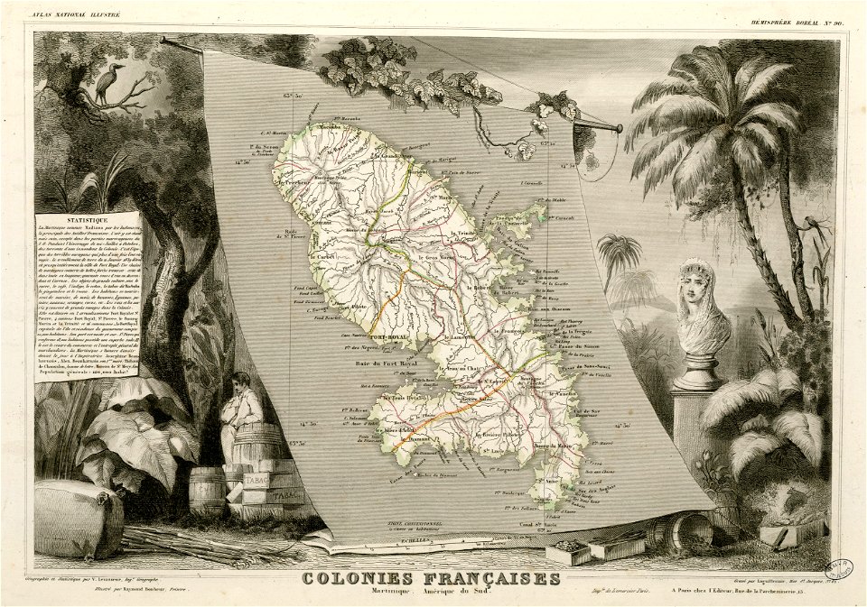
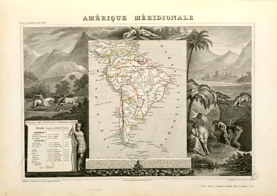
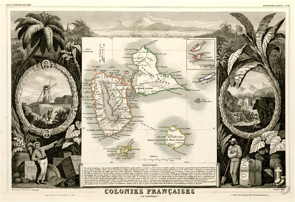
victor levasseur - maps of the world
fonds ancely - bibliothèque municipale de toulouse - maps
cornell university library
cornell: persuasive cartography: the pj mode collection
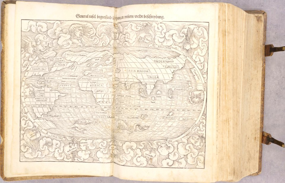
mercator 1569 world map
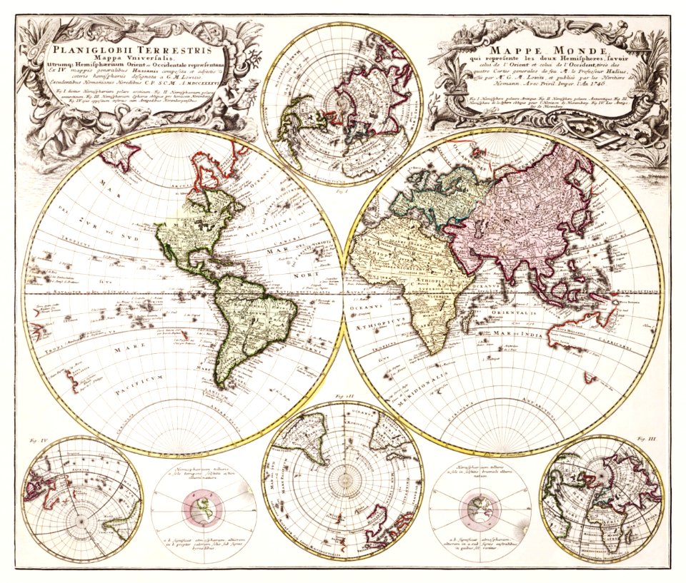
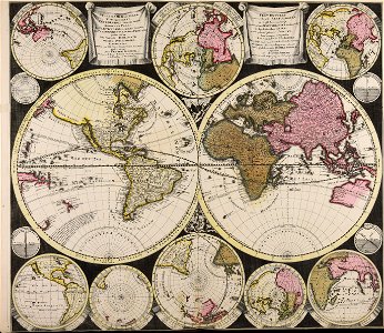
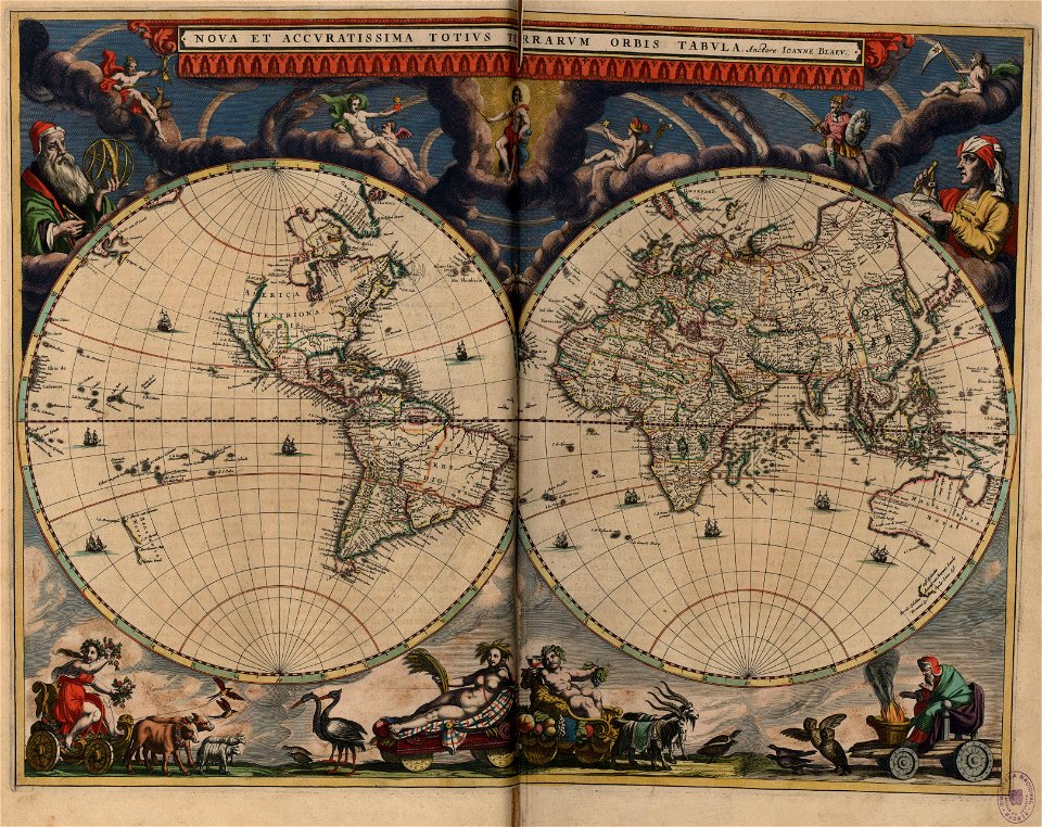
18th-century double hemisphere world maps
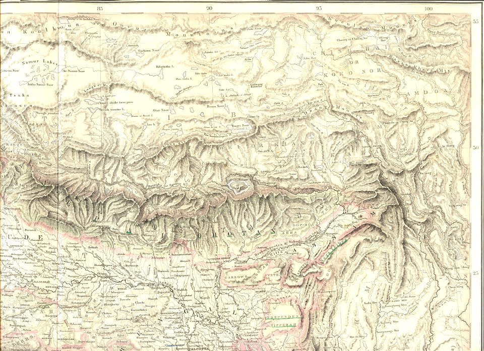
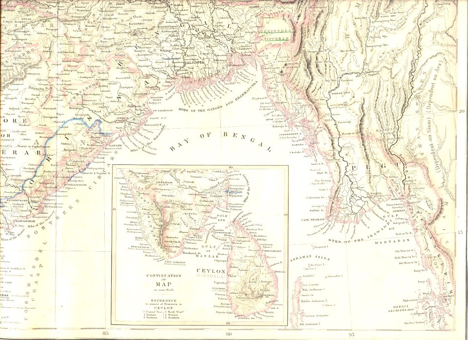
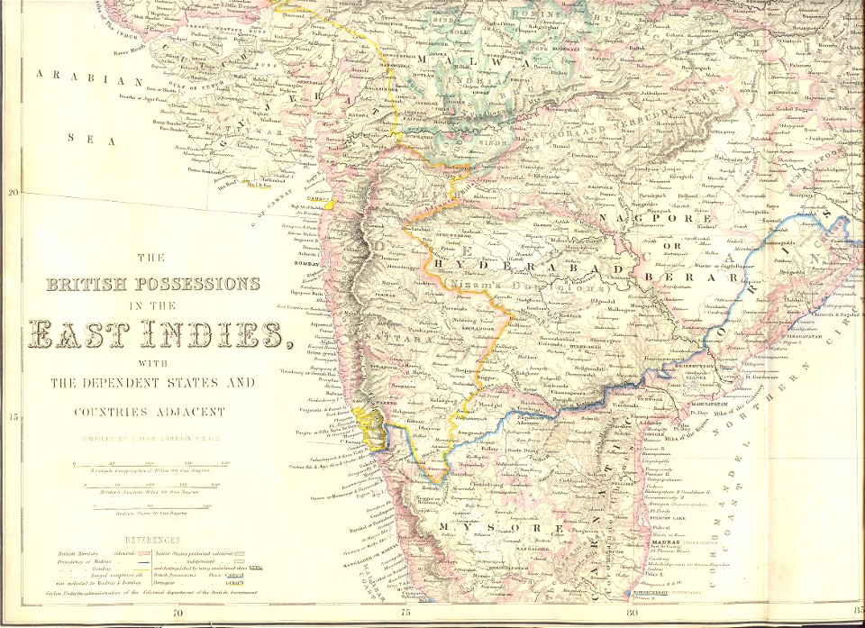
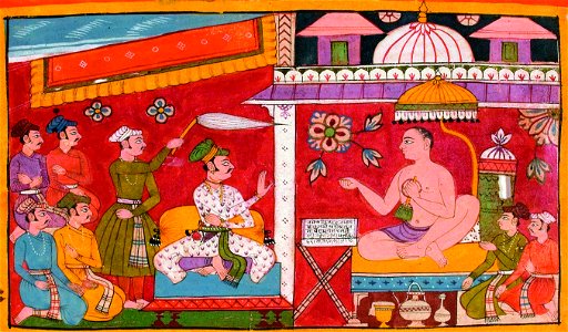
19th-century maps of india
victor levasseur - maps of the world
frédéric-auguste laguillermie
world
maps
old maps of austria-hungary
austro-hungarian army
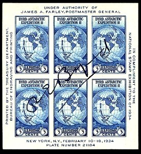
1934 stamps of the united states
blue stamps
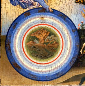
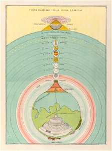
geocentric model
world map
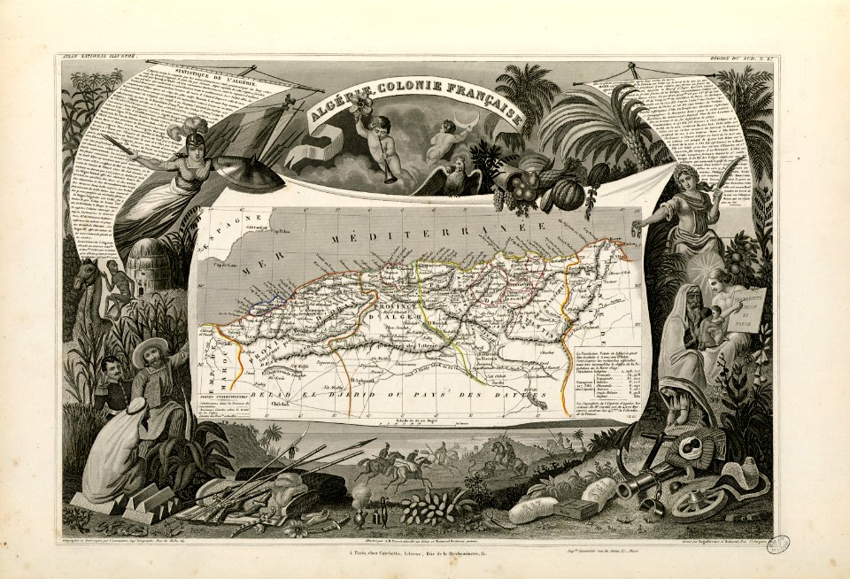
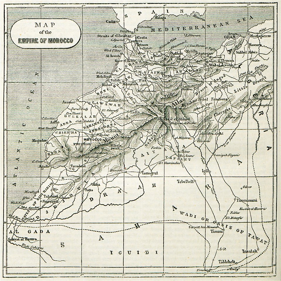
old maps of algeria
french algeria
atlantis magni tomus primus (biblioteca comunale di trento)
maps by pieter schenk (i)
maps
sea
cornell university library
gibson girl
arabic-language manuscripts
bodleian library
ukiyo-e by unknown artists
1870s maps of the world
brazil
maps
travel
maps
old maps of the world
1880 maps
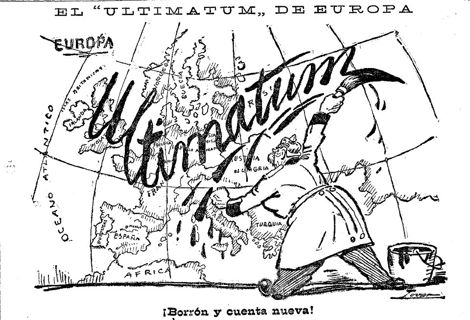
caricatures by manuel tovar in el imparcial
1914
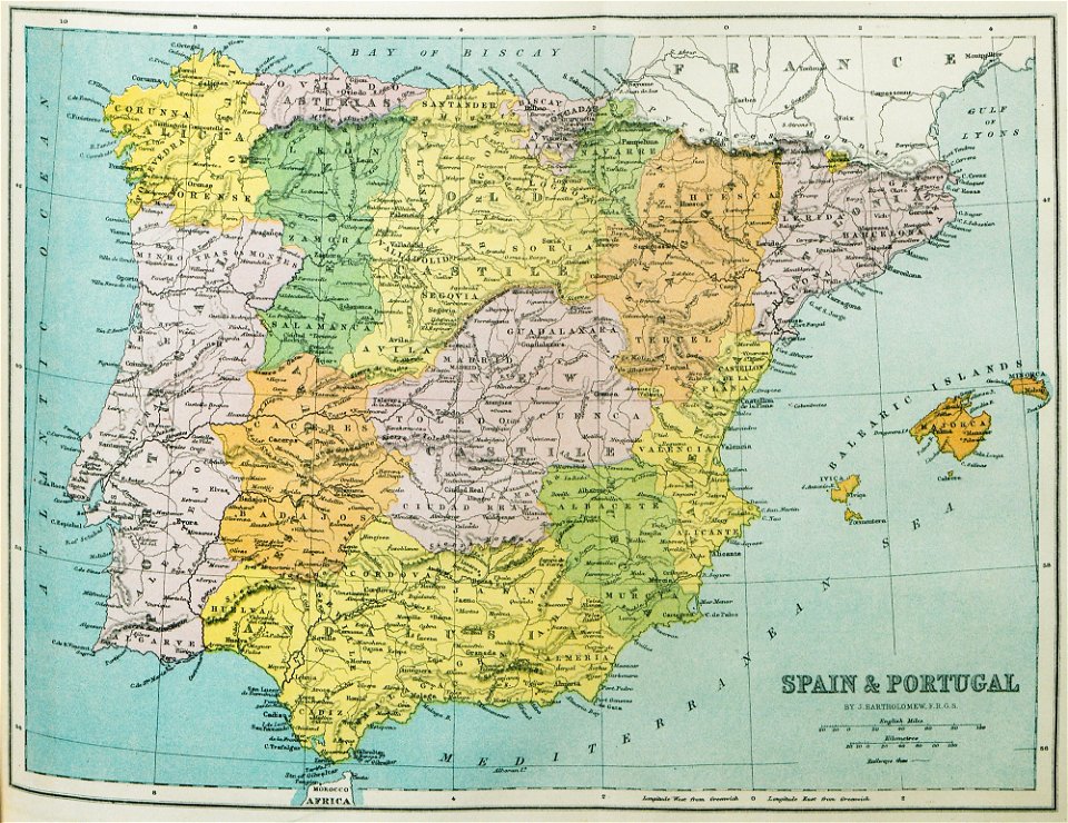
old maps of the iberian peninsula
1870 in spain
world map
maps
victor levasseur - maps of the world
historical images of arecaceae
maps by nicolaes visscher i
claes jansz. visscher (ii)
fonds ancely - bibliothèque municipale de toulouse - maps
victor levasseur - maps of the world
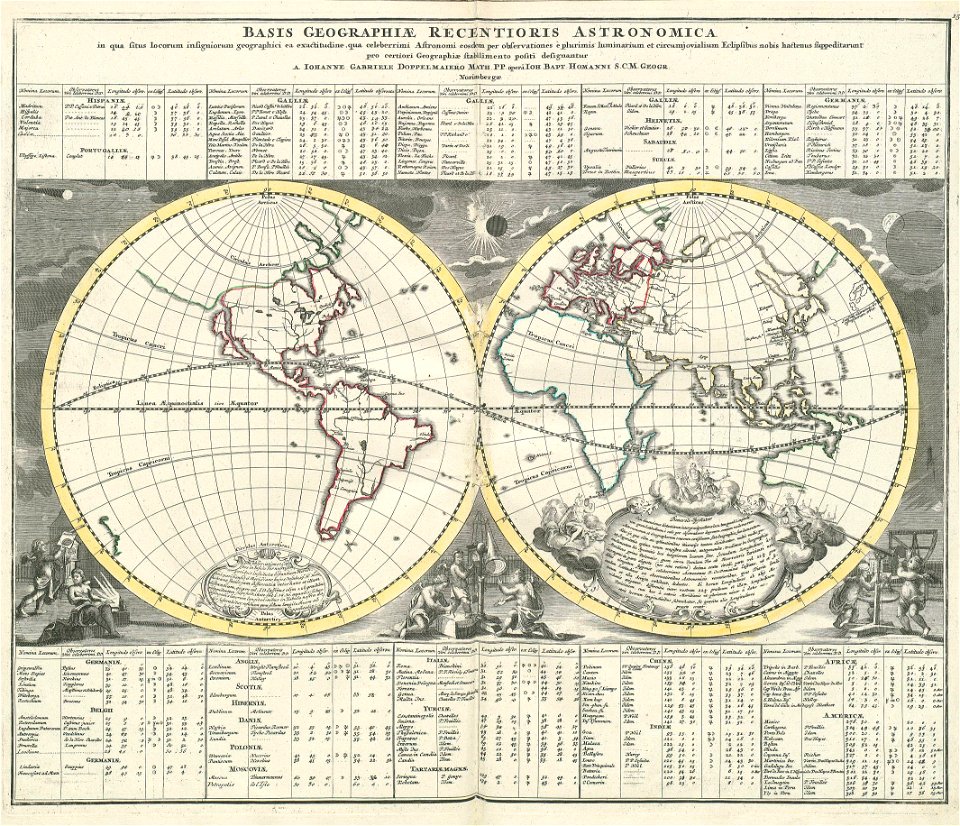
„atlas coelestis in quo mundus spectabilis“ by j.b. doppelmayr
double hemisphere world maps
old celestial maps
gerard valck
victor levasseur - maps of the world
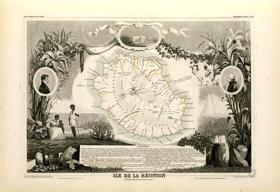
old maps of réunion
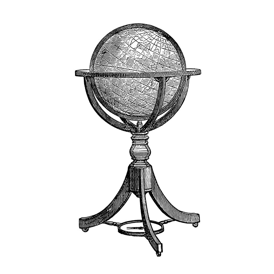
globe
maps
double hemisphere world maps
copper engraving
1550s maps of the world
1552
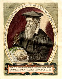
portraits with globes
frans hogenberg
popular science monthly illustrations/volume 10
ancient earth views
18th-century maps of the world
armillary spheres in art
prints from the peace palace library
1770s maps of the world
charts and maps of the royal museums greenwich
1626 maps
cornell university library
puritan
charts and maps of the royal museums greenwich
1626 maps
„atlas coelestis in quo mundus spectabilis“ by j.b. doppelmayr
double hemisphere world maps
popular science monthly illustrations/volume 34
navigation compass
old constellation maps
maps by samuel dunn
cornell: persuasive cartography: the pj mode collection
cornell university library
vintage
maps
cornell university library
cartography
19th-century maps of india
travels and adventures in all parts of the globe (1870)
all round the world: an illustrated record of voyages
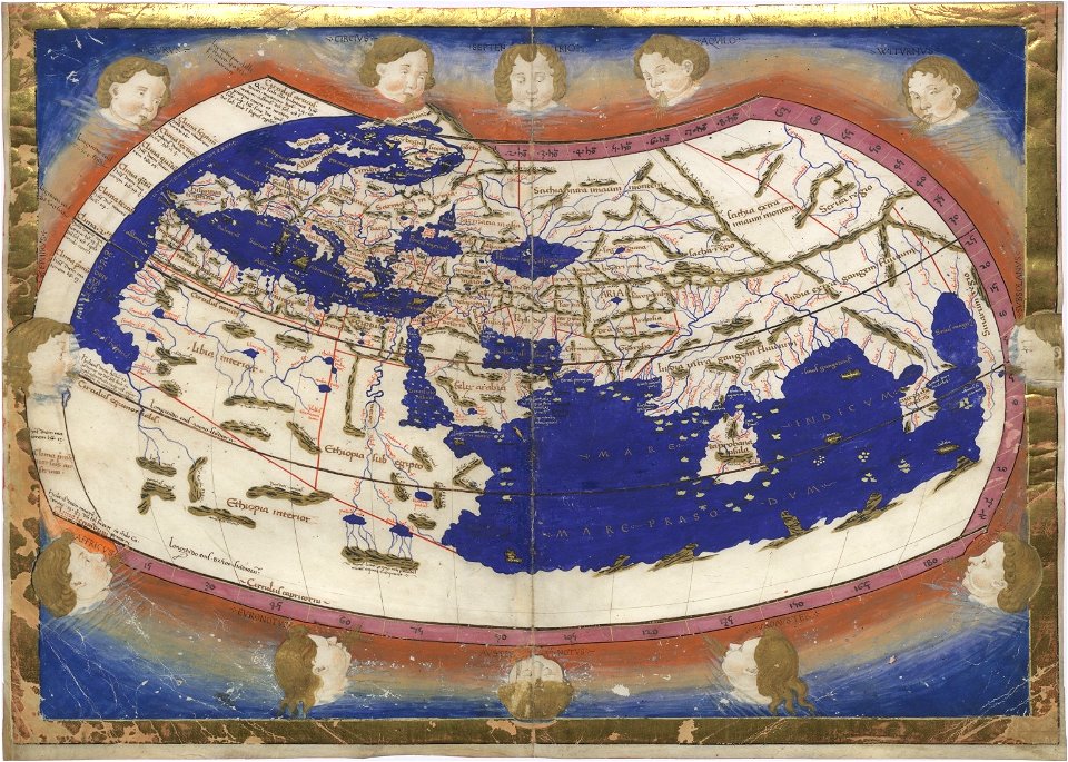
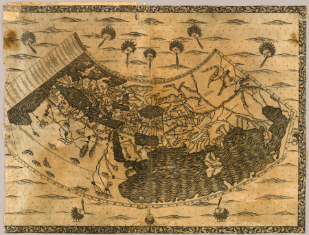
cosmographia claudii ptolomaei alexandrini
age of discovery
travels and adventures in all parts of the globe (1870)
all round the world: an illustrated record of voyages
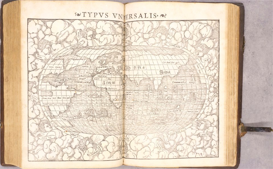
cosmographia - beschreibung aller lender durch sebastianum munsterum (1545)
1540s maps of the world
cornell university library
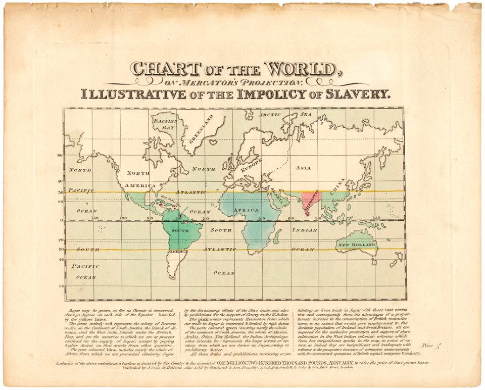
abolitionism
19th-century maps of india
19th-century maps of india
19th-century maps of india
19th-century maps of india
cornell university library
thomas paine
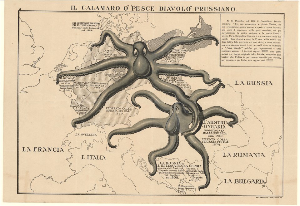
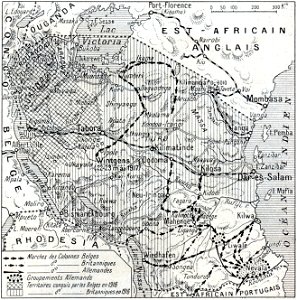
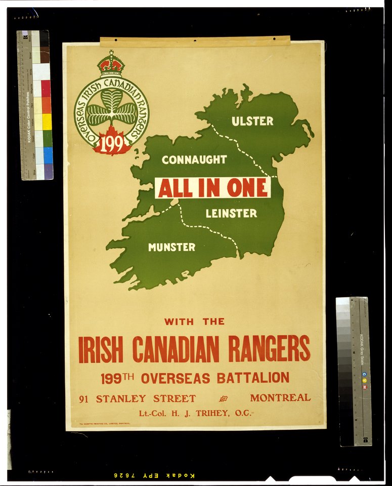
african theatre maps of world war i
no 3908 illustrations
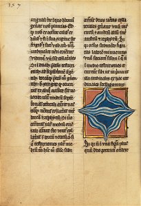
ms. ludwig xv 4 (getty museum) - bird book of hugo fouilloy
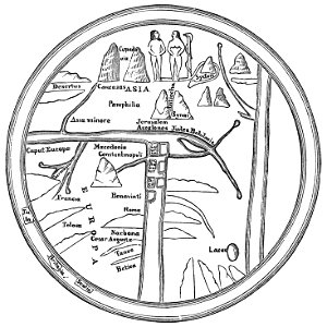
13th-century maps of the world
coats of arms of switzerland
coats of arms of italy
san diego museum of art
1636 in art
san diego museum of art
1636 in art
world war i posters in the library of congress
cef
world war i posters in the library of congress
cef
world map
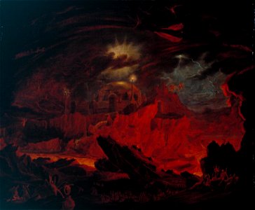
hell
book collection of the chester beatty library
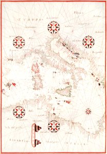
l'isole più famose del mondo
maps by willem and johannes blaeu
atlas van loon
history of antwerp
renaissance
afonso v of portugal
fra mauro map
crowns in art
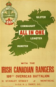
shamrock
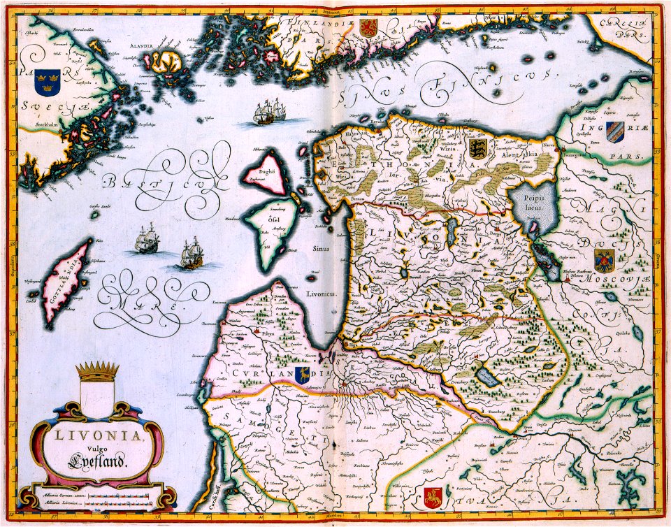
livonian
curonian
diego gutiérrez
renaissance
old administrative maps of the ottoman empire
1909 maps of asia
afterlife
world map
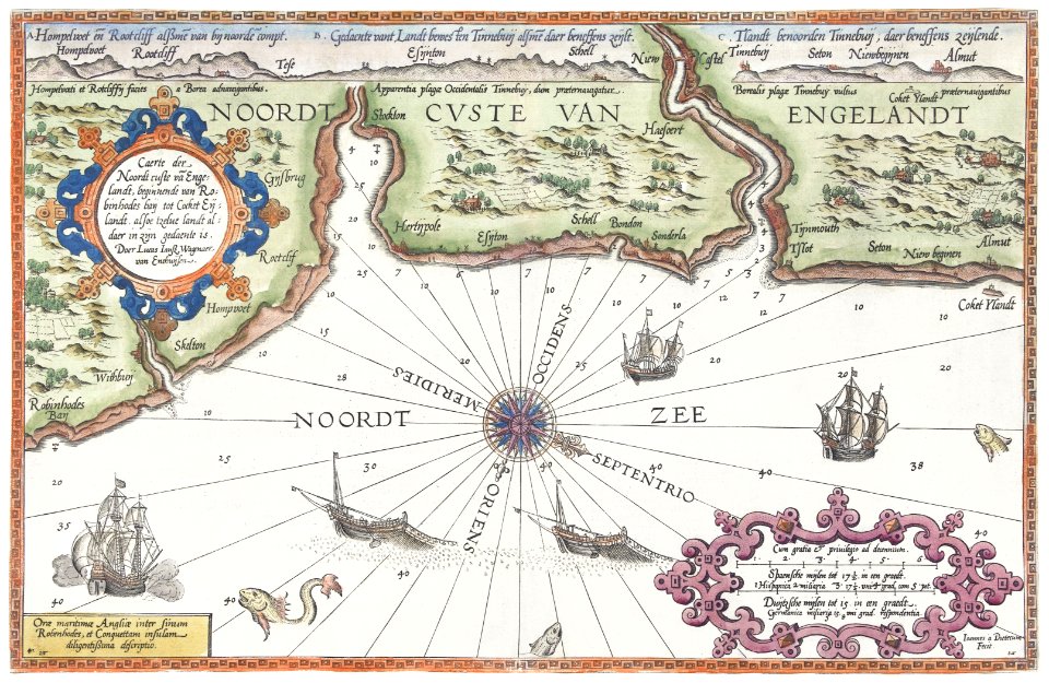
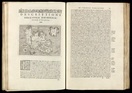
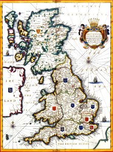
old maps of the british isles
victorian era
1474 maps
1928 maps
maps by jacques-nicolas bellin
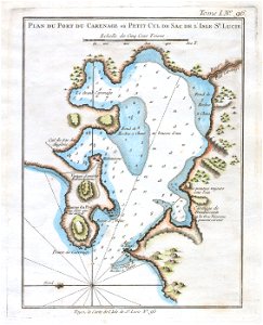
old maps of saint lucia
german empire
east germany
1640s maps of the world
1660s maps of the world
18th-century double hemisphere world maps
1720s maps of the world
old maps of the british empire
illustrations by walter crane
maps by nicolaes visscher i
prints by nicolaes berchem
al-andalus
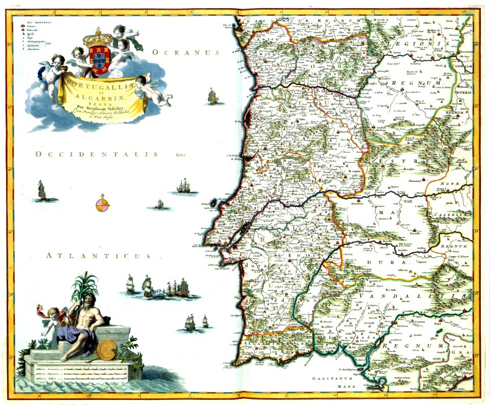
portugal
maps by edward wright
molyneux globes
1690s maps of the world
copper engravings
maps by thomas kitchin
andrew dury
maps made in the 16th century
johannes ruysch
details of old maps of the world showing "aquita" in japan
johannes baptista vrints
illustrated title pages
1645 books
may 2023 in venice
fra mauro map
1590s maps of the world
1595 maps
bird's-eye views of paris
engravings of paris
maps by willem and johannes blaeu
old maps with mercator projection
maps of the world with orthographic projection
maps of the world without antarctica
maps by willem and johannes blaeu
1660s maps of the world
alphabet charts
lord's prayer
maps by edward wright
molyneux globes
maps with figures
michael burghers
fra mauro map details
old maps of thailand
edward wright (mathematician)
maps by jodocus hondius
1520s maps of the world
propaganda map
the geographical distribution of animals (book)
zoogeography
maps by jodocus hondius
1595 maps
maps of the league of nations
1929 maps of the world
maps of the world without antarctica
1820s maps of the world
beschreibung der städt der welt - braun & hogenberg - btv1b52512111k
maps of munich by braun & hogenberg
world war ii posters from the united kingdom
her majesty's stationery office collection
301 - 400 of 1,785
Next page
/ 18